An aviation record, documented properly
In 2008 two pilots flew a factory-standard helicopter around the world in eleven days, and the record has stood ever since. The story existed in fragments: press clippings, a record body’s database entry, and memory. This is what it looks like assembled into something permanent.
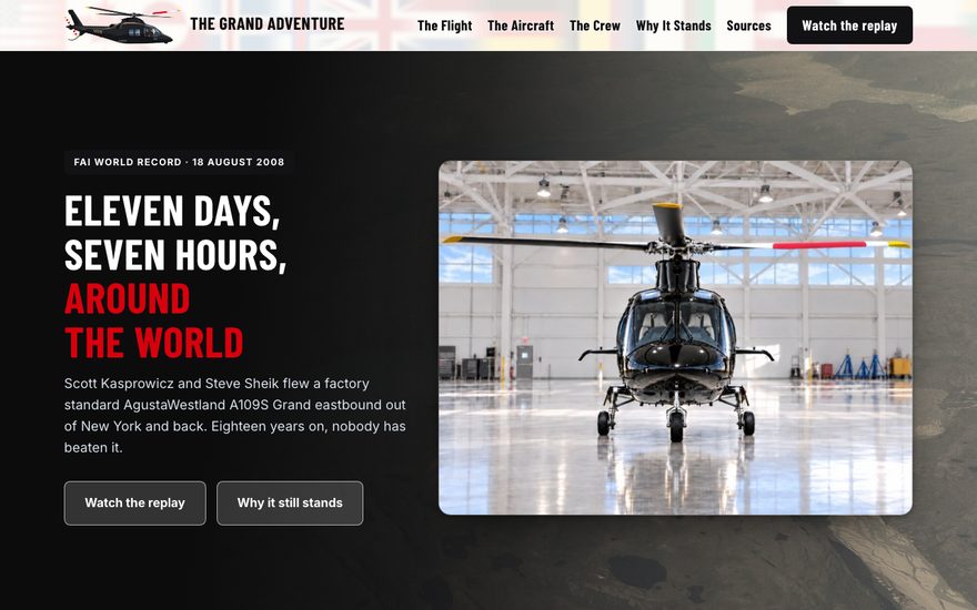
A record with nowhere to live
Records like this one usually end up as a paragraph on a database page and a few articles that rot. Eighteen years on, somebody looking for the actual story finds contradictory dates, wrong aircraft details, and no way to see the route.
The brief was not “make a website.” It was: make this checkable, and make it last.
Research first, then the site
Most of the work was not front-end work. It was reconciling sources against each other and deciding what could actually be stated.
The archive
Seven pages, each doing one job: the flight itself, the aircraft, the crew, an analysis of why the record has survived, and a sources page that shows its working.
- Every factual claim traced to a named source
- A method page explaining how conflicts between sources were resolved
- Anything that could not be corroborated left out rather than softened
The 3D replay
The centerpiece. The entire eleven-day route flown back over real elevation data in the browser, with no plugin and nothing to install, covering seventy-eight fuel stops across seventeen countries.
- Real terrain, not a flat map with a line drawn on it
- Runs on a phone as well as a desktop
- Built on open mapping data rather than a licensed platform, so there is no per-view bill to inherit
Built to outlive us
An archive that stops working in three years has failed at the only thing it was for. So there is no framework, no build step, and no dependency that needs feeding.
- Hand-written HTML and CSS, 120 KB for the whole site
- No CMS to be exploited and no plugins to patch
- Hosted anywhere static files can sit, at effectively no cost
Sources disagree, and somebody has to decide
The hardest part of this project had nothing to do with code. Eighteen-year-old press coverage contradicts itself constantly, and an archive that repeats the contradictions is just a tidier version of the mess it replaced.
The sources page is not an appendix nobody reads. It is the thing that makes the other six pages worth trusting, which is why it is in the navigation rather than the footer.
A line on a map is not the story
The flight was hard because of where it went: the Bering Strait, Siberia, the North Atlantic. A flat map with a route drawn on it communicates none of that, because the terrain is the difficulty.
What it does
- Flies the full eleven-day route in sequence
- Real elevation data, not a flat projection
- Seventy-eight fuel stops in place along the way
- Scrub to any point in the flight
- Works on a phone, with no app and no plugin
How it is built
- Open mapping and terrain data
- No licensed platform, so no per-view billing
- Route data held as plain coordinates
- Degrades to a static map if WebGL is unavailable
- Nothing that expires when a vendor changes plans
Why it matters
- It is the reason people stay on the site
- It makes the distances legible at a glance
- It cannot be replicated by a press article
- It costs nothing to keep running
- It will still work in ten years
Why this one is in the portfolio
It is the clearest example of scope not being the limit here. Research, editorial, design, engineering, and 3D work, all on one project.
A larger shop would have split this across a researcher, a writer, a designer, a front-end developer, and whoever owns the map integration, and the seams would show. The route replay would have been scoped out in week two as a nice-to-have.
Instead the hardest part is the part people came for. That is usually the right way round, and it is only available when the people deciding what to cut are the same ones who know what it costs to keep.
Ambitious is welcome here
If you have a project that keeps getting quoted down to something smaller, describe it and you will get an honest read on what it would really take.
Describe the project